Communities
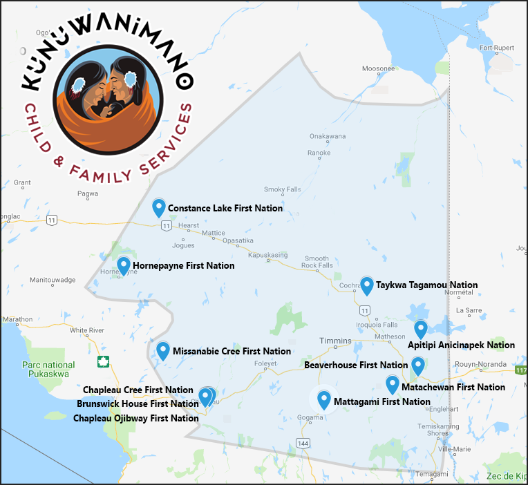
The Kunuwanimano catchment area encompasses a broad region in Northeastern Ontario that ranges from Hornepayne to Matachewan First Nation and includes eleven First Nation communities. The Kunuwanimano head office is located on Apitipi Anicinapek Nation with the main office located in the city of Timmins.

First Nations
Territory Descriptions:
Kunuwanimano Child and Family Services
North of the 47.5 Parallel at the Southern boundary of the Arctic Watershed, North to Payukotayno jurisdiction, west to Tikinagan jurisdiction, east to the Province of Quebec (approx. 139,000 square kilometers)
Payukotayno Child and Family Services
- South from Hudson Bay at the point 85 thirty minutes to the Albany River(including Peawanuck)
- Westward on the south shore of the Albany River to the boundary of the District of Thunder Bay (not including Marten Falls Indian Reserve and Ogoki)
- South on 90° longitude to 50° latitude
- South along the boundary of the District of Thunder Bay to the 50th parallel
- East along the 50th parallel to the Ontario/Quebec border
- North following the Ontario/Quebec border to the coast of James Bay (including Moose Factory Island and the islands in the mouth of the Moose River)
Tikinagan Child and Family Services
- South from Hudson Bay (85° 30 min. longitude) to Albany River (not to include Peawanuck)
- Westward on Albany River to the 90° longitude (to include Marten Falls I.R. and Ogoki)
- South on 90° longitude to 50° latitude
- West on 50° latitude to boundary of District ok Kenora
- North on Kenora District Boundary to 51° latitude
- West on 51° latitude to 92° longitude
- North on 92° longitude to 51° 30 min. latitude
- West on 51° 30 min. latitude to Manitoba Border
- North and north east along the Manitoba/Ontario border to the shore of Hudson Bay
- East along the shore of Hudson Bay to the point of commencement

